This is a circular ride with something for everyone. Only 6 miles long, starting from Derby City Centre, and having history by the bucketful. Nice riverside views, lots of pubs and cafes, a selection of public toilets en route, and a rare bovine (rare in Derby at least!). In fact something of interest at every turn.
Although the second half of the route passes through the city centre, it is mostly in bus lanes, and if you are not confident in traffic, best ride it on a Sunday, when there is very little traffic on the streets.
An excellent free map of this ride is available from Cycle Derby at the Council House, or from the Tourist Office in the Market Place.
Fasten your seatbelts, here we go.
We start with our backs to the Cathedral, at the statue of Bonnie Prince Charlie, with the Old Silk Mill, (now Industrial Museum) ahead of us, beside the River Derwent.
Map of route by kind permission of Derby City Council.
Click to enlarge.
Follow the path towards the river, aiming for the right hand corner of the mill. On the left you will see the magnificent wrought iron gates made by Robert Bakewell and cross multi-coloured tiles which represent the efflux from the great water wheel which powered the machinery of the mill.
On the right you will see the pedestrian swing bridge built a few years ago, across which we will return on completion of the ride.

We are to follow Route 54 of the National Cycle Network for the first part of the ride, and this takes us between the river bank and the Silk Mill.
Look back to see a panoramic view of Cathedral Green and the magnificent 212ft high tower built between 1510 and 1530. During WW2 a stray barrage balloon brought down one of the corner pinnacles from the top of the tower.
At St.Mary's Bridge we pass through the left hand arch.
Along the Riverside Path............
........................to Handysides Bridge, which used to carry the Great Northern Railway tracks across the Derwent.

Turn up the rising path on the left here, to cross the River Derwent ..........
............................................on the deck of the bridge.
We have two options of route on the other side of the bridge. The riverside path is closer to the water, but is narrow and rather too popular with dog walkers, so we will go straight on through the car park ahead.
Note the cycleway signs here are black instead of the usual blue. This is because the nearby Chester Green is a conservation area where all signs and bollards are black.
Straight across the car park then to turn left on City Road which leads us into Darley Fields.
The railway ran on a high embankment here and a steel bridge crossed City Road.
This way then.
Look back to see the empty shell of the mighty Prestige Works, which once turned out thousands of pressure cookers, saucepans and kettles.
On the left as we cycle along City Road, is Parkers Piece, onetime sports venue for Derby School, then at St. Helens House in King Street. Close by the cricket pavilion in 1928, the foundations of a Roman building were excavated. It had under-floor heating using stone passages.
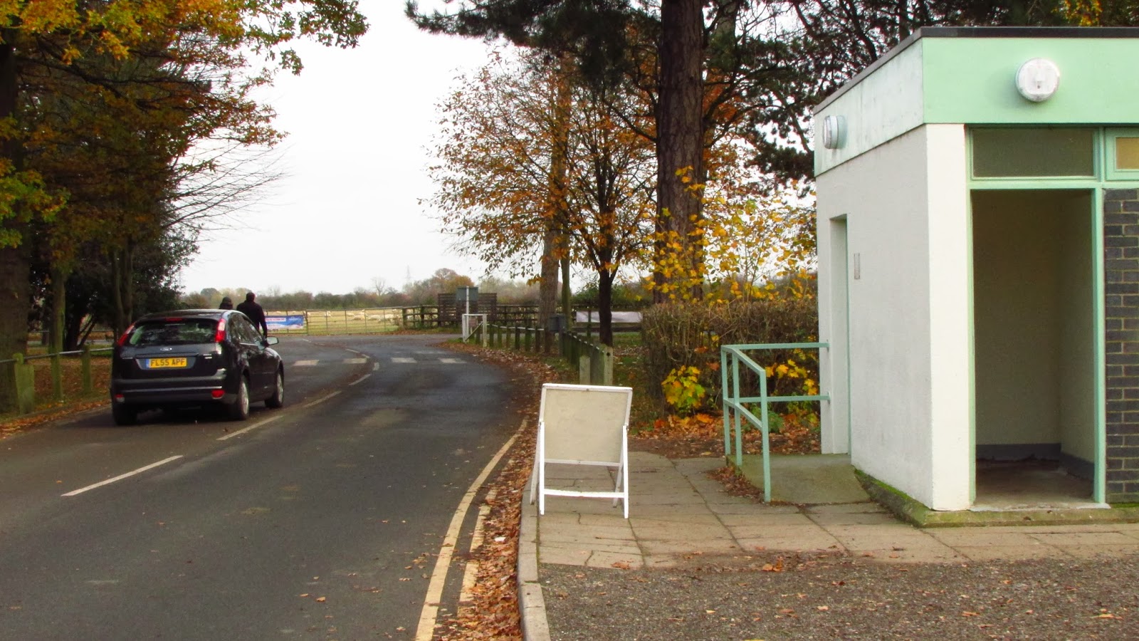
Straight on at road junction to enter Darley Fields where there are public toilets (See below).
Tennis courts on the right of the path which runs parallel between rows of mature trees, following the river to Darley Abbey village. Ignore the No Entry signs..
To the left is another opportunity here to join the riverside route.
A good tarmac surface through to Folly Bridge.
which is here, a replacement for the one which was carried away by the floods of 2001
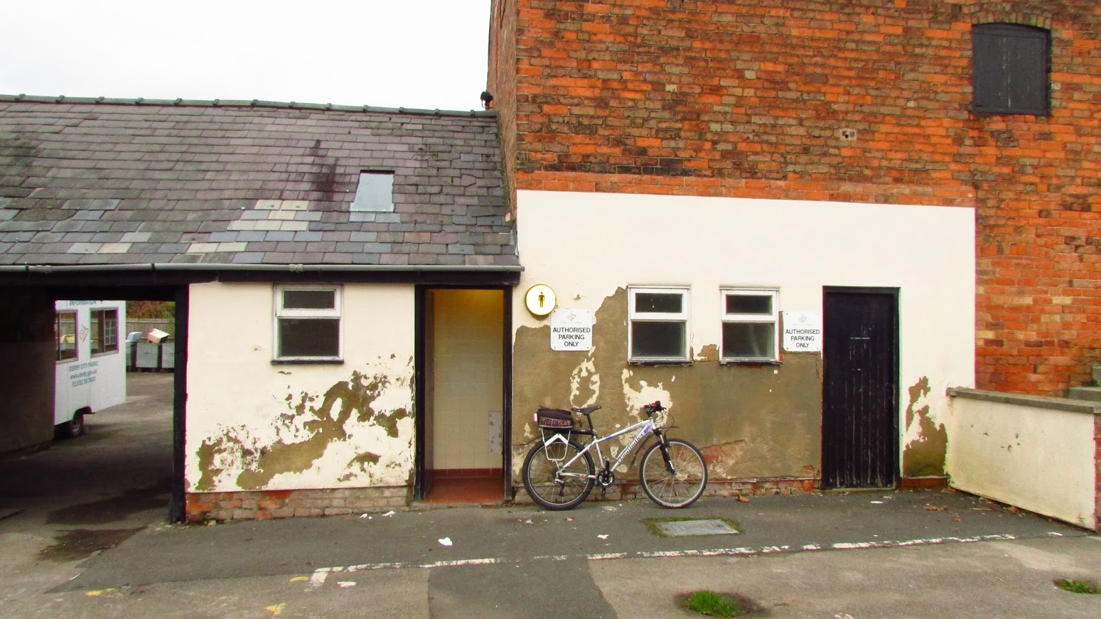
Along Folly Road now with Derby Rugby Club on the right, it's entrance being on Haslam's Lane which lies ahead. There is a bar there and they serve good food at sensible prices. Also toilets here.
Turn left at tee junction with Haslam's Lane...............
...................heading towards Evan's Mill ahead.
Look in field on the right to see Oink, Derby's only water buffalo.
This is Oink. He is 15 years old and said to be "a big softie".
Sadly Oink died on 12th December 2013.
And enter the mill complex heading for toll bridge, but not to worry, the toll applies only to cars.
The once mighty cotton mill is home to a number of small businesses and there is talk of major re-furbishment with lottery grants, as the site is deemed to be of major historical importance.
The Toll House.
And the toll bridge.
To the left looking downstream, is the weir.
As we turn left after the bridge, look to the right where this excellent multi-user path runs to the Midland Canoe Club's building and on towards the A38 crossing and Allestree.
Looking left across the river as we enter Darley Abbey village is a good view of Evan's Mill.
Straight ahead on Old Road, noting lots of lovely old houses which would have been occupied by the
workers at the mill.
Here the Abbey, actually a pub but was once the Abbey of Darley
View from other side.
A strange cast iron notice on one of the cottage walls. You have been warned!
The route would normally go uphill on New Road and through Abbey Yard into Darley Park, but that route is out of action currently (November 2013), due to building work, so we have to take a diversion past the cricket field and the outdoor centre.
Update 12th August 2014
The diversion is still necessary as the building work is not yet complete.
However, we are assured that it will be finished "within a few weeks".
So this is the way. Cross the car park ahead.
We now enter Darley Park, following the path to the right, passing the Outdoor Centre (right) which has a Dutch barn style curved roof.
Keep right, climbing uphill towards the café
There is an excellent café here in Darley Park, with lots of outdoor seating.
More toilets behind café.
Opposite the route goes uphill to exit from the park
Looking downhill to our left we can see the River Derwent across the park.

Exit the park at these gates onto Darley Grove.................................
...........which leads up to Duffield Road and the roundabout at the Broadway Hotel (below).
Cross Duffield Road here..........................
Onto Broadway
Left onto this service road as we approach Kedleston Road.
Use this crossing for safety.
Turning right on this cycle lane towards the A38 bridge,
Keep on the cycle path alongside the A38, actually out of shot left in this picture, which shows the Curly Bridge ahead, and past that the dreaded Markeaton roundabout.
Turn left before the Curly Bridge ramp here.
Pass the University buildings on Markeaton Street.
Then pass Brittania Mill (University Arts department).
Left at cross roads onto Mackworth Road
Right onto path in Markeaton recreation ground, following line of trees below.
Straight on between houses
Straight onto road at end of path
Straight on at cross roads
Cross Ford Street (Inner Ring Road) here at Joseph Wright Centre to Willow Row.
Willow Row has an excellent cycle path
Onto road at Bold Lane.
Bold Lane. The large building on the left was a theatre where Charles Dickens once gave a lecture
Bold Lane to The Strand. Cheapside right. Sadlergate left.
.

Enter Victoria Street using bus lane. St. Jame's street on left
Through Victoria Street.
Albert Street with Northcliffe House ahead.

Turn right after Ossnabrook Square at Council House roundabout into the Morledge.
Then take cycle path between the Courthouse and Jimmy's restaurant towards river bank.
Turn right on reaching the river bank to pass the new hydro-electric plant which supplies electricity to heat and light the Council House.
Left fork after passing beneath bridge.
Turn left at blue sign to cross the river again on the Telegraph Bridge.
Ignore the "Cyclists Dismount" signs. They have no significance or legal standing.
Left at road.
On shared path (left) to pass under bridge.
Look to your left to see the weir, hydro power station and Riverlights complex.
Cross Derwent Street at Exeter Bridge, right on far side then turn left into Stuart Street.
This view is soon to be improved with the demolition of the ugly and derelict Police Station.
Left at blue sign to re-cross river on the Swing Bridge.
Cross the swing bridge to re-join Bonnie Prince Charlie on Cathedral Green.
Hope you enjoyed the ride, be it on your bike, or in the comfort of your armchair.