The Tramway Trail is a 6.3 mile long circular walking and cycling path around the Calke Abbey Estate in South Derbyshire. The house and the estate are both owned by The National Trust.
Calke Abbey is about 13 miles South of Derby and 11 from Mickleover.
The Tramway Trail has been laid out by the National Trust who own Calke Abbey and the surrounding estate. It follows the route of a narrow gauge railway where horses were once used to pull wagons carrying stone and other materials in the Ticknall area.
Click on images to see them full screen.
The route starts from the Abbey where cars may be parked and where there is an excellent cafe with toilets. NT members park for free.
En route from Derby you will have to cross the River Trent at Willington or Swarkeston aiming for the main entrance in Ticknall.
If you go via Repton and Milton, call in at Foremark Reservoir which is well worth a visit. Toilets and a small cafe here
View looking towards the dam at Foremark.
A fine place to watch boats on the water where Burton Sailing Club have a base.
On then to Calke Abbey and the Tramway Trail .......................
Best to start here at this gate which is opposite where the main entrance road turns 90 deg left after the pay booth.
Here we go then on the new and very attractive cycle path ................
.................................. but don't be fooled. it isn't this good all the way.
On into the woods where the path is not yet finally surfaced.
One of the few short climbs here.
And on through the fields surrounding the path.
Here we pass to the South side of Ticknall village visible across the field on the right.
Here is the tunnel, where lights on your bike are useful, and if you are lucky, this dog will lead you through the tunnel. See video of this dog which has tunnel vision.
A straight stretch here through more open ground.
A couple of stone bridges cross the cutting.
The track now leads alongside the road back to Calke Abbey. The path surface is rather poor here.
Here we return to the Abbey at the end of the ride. Note that the narrow tarmac road ahead is one way for traffic and you should turn right there to exit the grounds in the direction of Staunton Harold and head homewards via Melbourne and Kings Newton.
Thanks to The National Trust who have put a lot of effort and cash into this cycling and walking route. Also for their vision in keeping the Abbey in it's original condition when they came into ownership.
A single visit to the building is not sufficient to appreciate what it contains. Along with Kedleston Hall, another NT property a few miles away, it has become a major tourist attraction locally.
To the West of Derby, the suburbs of Mackworth and Mickleover are separated by a green wedge of fields known as Mick/Mack Park, through which National Cycle Network Routes 54 and 68 pass. Although close by the busy A38 trunk road, the path is traffic free, well surfaced and lined with mature trees.
This ride visits the lowest and the highest points in NW Leicestershire, one being Cloud Hill Quarry, the lowest, and Breedon Church, the highest.
The Cloud Trail is a part of National Cycle Network Route 6 running into Leicestershire from Derbyshire. Just South Of Breedon-on-the-Hill is Cloud Hill Quarry, a gigantic hole in the ground where millions of tonnes of rock are extracted yearly to satisfy the demand for road building and concrete manufacture.
Most of the route is flat, off road, and hard surfaced The main route shown above is from Mickleover, but an alternative is to join NCN Route 6 from Derby City Centre going through Alvaston Park and Shelton Lock. Either route brings us to Swarkeston where we follow the Trent and Mersey Canal to Weston where we cross the River Trent to follow the Cloud Trail into Leicestershire.
Sinfin Moor Lane
Infinity Park Way
NCN Route 6 now leads us to Swarkeston Lock following the line of the derelict Derby Canal.
Here on the bridge at Swarkeston Lock we look downstream on the Trent and Mersey Canal. On the right of the canal is the path to Weston.
A nice ride alongside the canal.
Crossing the River Trent.
View looking Westwards towards Willington.
On NCN Route 6 near the site of Melbourne Station
On the right here is the path to Wilson on the Cloud Trail. We return to this point on the return journey.
Pushing on towards Tonge.
Looking back at Tonge Station, now a private house.
After crossing the A42 trunk road we go onto the Cloud Trail which takes us to ...............................
...........................................Cloud Hill Quarry
........................ watched over by these mythical creatures.
They are called The Rock Drills
After returning to re-cross the A42 we follow the road to Breedon where the Priory Church stands high above the village.
View of the pretty village of Breedon-on-the Hill with the top of the church tower just visible (top left). There is an excellent cafe at the Garden Centre.
A steep climb up to the church ............................
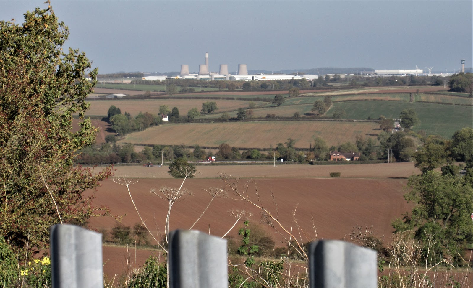
............. but well worth it for the views on all sides. Here we see Ratcliffe Power Station and on the right East Midlands Airport.
From Breedon Church, we return to NCN Route 6 by way of Wilson village.