Pages

Wednesday, 22 April 2015

The Nutbrook Trail

The Nutbrook Trail runs along the Erewash Valley on the Derbyshire/Nottinghamshire border.  It is easily accessible from the train station at Long Eaton and runs northwards to Shipley Park where there is an excellent café at the Visitor Centre.
The route is almost entirely flat, completely traffic free and well signed as Route 67 of the National Cycle Network. For most of it's length it has a tarmac surface suitable in all weathers and for all kinds of bicycle, even those with the flimsiest of tyres and the most fragile of frames.
The length of the route is 11.5 miles from the station here to the Visitor Centre at Shipley Park
Trains from Derby are frequent and the cost is very reasonable.
An Anytime Day Return cost only £2.95 with my Senior Rail Card and of course bikes go for free.

Click on pictures to enlarge them.

On alighting at Long Eaton train station we follow the signs towards the town centre, that is straight ahead here..

                   We soon catch sight of the Erewash Canal which runs alongside the road.


                                      And have a choice of riding on the towpath ........................


     ................... or on the excellent shared path alongside, which does have the better surface.


                               Eventually however, we have to take to the canal towpath


The canal passes many industrial buildings and the route has been well marked by the Erewash Valley Sustrans Rangers. There is no need for maps, as you cannot get lost if you follow the "67" signs..


The signs lead us to leave the towpath for a short distance onto this raised embankment which runs parallel to the canal.

                                   As with all canals there are no hills except for the rises at locks.
                                           This is the approach to Sandiacre  Lock.

.                                            With it's picturesque lock keeper's cottage.


And at the head of the lock the closed off junction with the redundant Derby Canal, which one day will re-open to join the Trent and Mersey Canal at Swarkestone where Route 6 of the NCN runs from Derby into Leicestershire.  This will include a cycle friendly towpath and give us the option of a great circular ride back to Derby.
It will cost many millions of pounds and take many years to re-open the Derby Canal, but the  Derby and Sandiacre Canal Trust are working to this aim, which will transform the area for leisure and industry. A massive National Lottery Grant would seem to be the most likely source of funding but a generous and wealthy benefactor would be acceptable, so should you happen to inherit a few million pounds and don't know what to do with it, you might like to consider this project.

The canal passes through the urban areas of Long Eaton, Sandiacre and Stapleford and many of the house owners have gardens with moorings for their own boats.


The surroundings become more pastoral and you can see here the very high quality of the path and it's environs.

                             Eventually we have to leave the towpath, crossing the canal on this bridge


Take this gate where the route passes through the site of the now demolished Stanton Iron Works, the path being enclosed in high steel fencing, remaining of high quality in spite of the industrial detritus on the other side of the fence.


.


As some recompense for the uninspiring landscape behind the galvanised fence we have this sculpture on the grass verge.

It is entitled "Wild Weeds Vetch" and there two similar ones in the area, one near to Shipley Park and one near to the ASDA Supermaket in Long Eaton..


            As we pass by the entrance to the Stanton Reclamation Centre the route goes up this slope.
                                         Watch out for heavy artics hereabouts.
    

We now enter a newer and more picturesque landscape following this lovely flat and straight traffic free road towards Shipley Park.


                                                    If only all roads were like this!


                                Follow "67" signs pointing towards Shipley Park and Heanor.


Having left the old railway route the path meanders and there are some slight gradients as we enter Shipley Park, a wonderful natural landscape and nature reserve.


                                     Watch out for Mr. Mole emerging from the grass verge.


                                             Several fresh water lakes visible from the path.


And several paths to the side, in this case carried on a bridge, over which this bower of blackthorn blossom hangs.


                                                   A final climb up the hill .....................................


.                                 ...........to the Visitor Centre where the café awaits.

                          Sit outside for a drink or some food if the weather is suitable.

TIP:
The daily specials are extremely good value and on Mondays the cakes are half price.
£1 is not bad for a great wedge of Victoria Sponge.  Just the thing for the hungry cyclist, and replaces all those calories that you have burned off getting here.

SUMMARY:
Derbyshire County Council, Erewash Borough Council and Sustrans have done a superb job here in trans-forming a grim and derelict landscape into the most beautiful and attractive countryside area which is as good for wildlife as it is for humans..
In particular Shipley Country Park is superb and we have seen but a small part of it here.
The route and the park give us a chance to get away from the pressures of modern life, the traffic, the noise and the never ending rush by manic motorists to get somewhere else as quickly as possible.
This route would score maximum points if it were not for the graffiti which has been sprayed on the lovely old stone walls and bridges by those morons who have nothing better to do and have no appreciation of beauty. You will find no photographs of such sacrilege here.

Friday, 20 February 2015

The Five Pits Trail

From Derby, the best way to reach the start is to take your bike by train to Chesterfield, since there are frequent services taking only about 20 minutes, and the cost can be as low as £2.65 using a railcard and searching the Internet to find the cheapest fare.

Before the ride, take a few minutes to view a couple of Chesterfield's sights, namely the statue of George Stephenson outside the station, and the famous Crooked Spire.
Click on pictures to enlarge them.

Here George stands holding aloft a model of the of the famous "Rocket" which kick started the railway revolution, whilst steadying his precarious balance on a wheel with a pair of engineer's dividers. Presumably they are set to 4feet 8 and 1/2 inches which became the standard gauge for railway tracks.  Isumbard Kingdom Brunel was livid, as he wanted it to be 6 feet.

Stephenson was not the archetypal " local lad done good" as he was born in Northumberland, spending only the last ten years of his life in Chesterfield at Tapton House, where he died in 1848.

However Chesterfield is proud to claim him as a local as he lived there during the construction of the Derby to Leeds railway route.

PS June 2015
On a more recent visit to Chesterfield I checked the span of George Stephenson's dividers and find that they are not set to 4f t 8.5 ins after all, but about 3ft.
Artist's license I suppose!


You cannot miss the 13th century Church of St. Mary and All Saints (better known as the Crooked Spire) which stands 228ft.high above the town, it's deformed finger still pointing heavenwards in spite of the twist caused by the use of un-seasoned timber in the construction.  The 32 tons of lead with which it is clad did not help. Some say that the Devil and some unspecified virgins had a hand in the deformation, but who knows?  Virgins in Chesterfield?  Come on  .................!.

One can but imagine the looks on the faces of those who funded the building as the spire took up it's (un)natural shape and wonder what happened to the builders. 
Did they receive full payment, or were they hounded out of town?
At least they could claim some credit for the integrity of the structure, since it did not fall down and has survived for 650 years.  The twist puts it out of true by over 9 feet and   presumably will not get any worse now.


But on with the ride, which takes us Southwards, through Grassmoor Country Park, after negotiating some busy roads and roundabouts. A short stretch of the A617 road turning off onto the Hasland Road B6033, through Hasland, making for Corbriggs where there is the entrance to Grassmoor Country Park.

                                                             And this is it.


Ignore the road to the right and pass through the gate on the left, following the winding path uphill. .


                         On the brow we see one of the many freshwater pools alongside the path.
There are also lots of seats where you can pause to rest, watch the wildlife or to admire the view.


Ignore all side paths and eventually you arrive at this brick bridge and this is the Northern end of the Five Pits Trail, which runs on for some seven miles.
From the undulating nature of the ground you would not think that this is a former railway route, in fact opened in 1892 to serve the coal mines at Tibshelf, Pilsley, Holmewood, Williamthorpe and Grassmoor.  As the mines closed around 1970, the railway became redundant and was subsequently taken over by Derbyshire County Council for conversion to this very fine Greenway.
The path surface varies and suitable for most bikes but not those with fragile frames, high gearing or flimsy tyres.


A typical view of the Five Pits Trail, going through open fields, with a gradient and imperfect but adequate surfacing.


The landscape of these former coal mining areas has undergone a remarkable transformation over the years with the removal of slag heaps and mining detritus, but there is now another threat from the prospect of industry in the form of fracking to extract oil and gas from the subterranean depths.  Test drilling in progress alongside the path.

                                    But there remain some more fine freshwater pools alongside.
                            Horses, dogs and presumably humans, are prohibited from entering the water.

 There are several road crossings on the Five Pits Trail, some of which would have been level crossings in the days of the railway and some of which would have been bridges, since demolished.


But in most cases, the trail continues on the opposite side of the road.


              Nice open pasture land with some farm animals, borders the path for much of it's length.


                        And some great views of the surrounding countryside from the many seats.

Looking back down one of the gradients as we come near to Tibshelf, better known for it's motorway service area, fortunately not in evidence here.

                                         The path narrows here as we wend our way to Tibshelf village...............


..........where we find a dedicated cycle crossing adjacent to a pedestrian crossing.


After the road crossing is this rather generous barrier (allowing through all but the widest handlebars and the fattest people) and we are approaching the most southerly end of the Five Pits Trail.


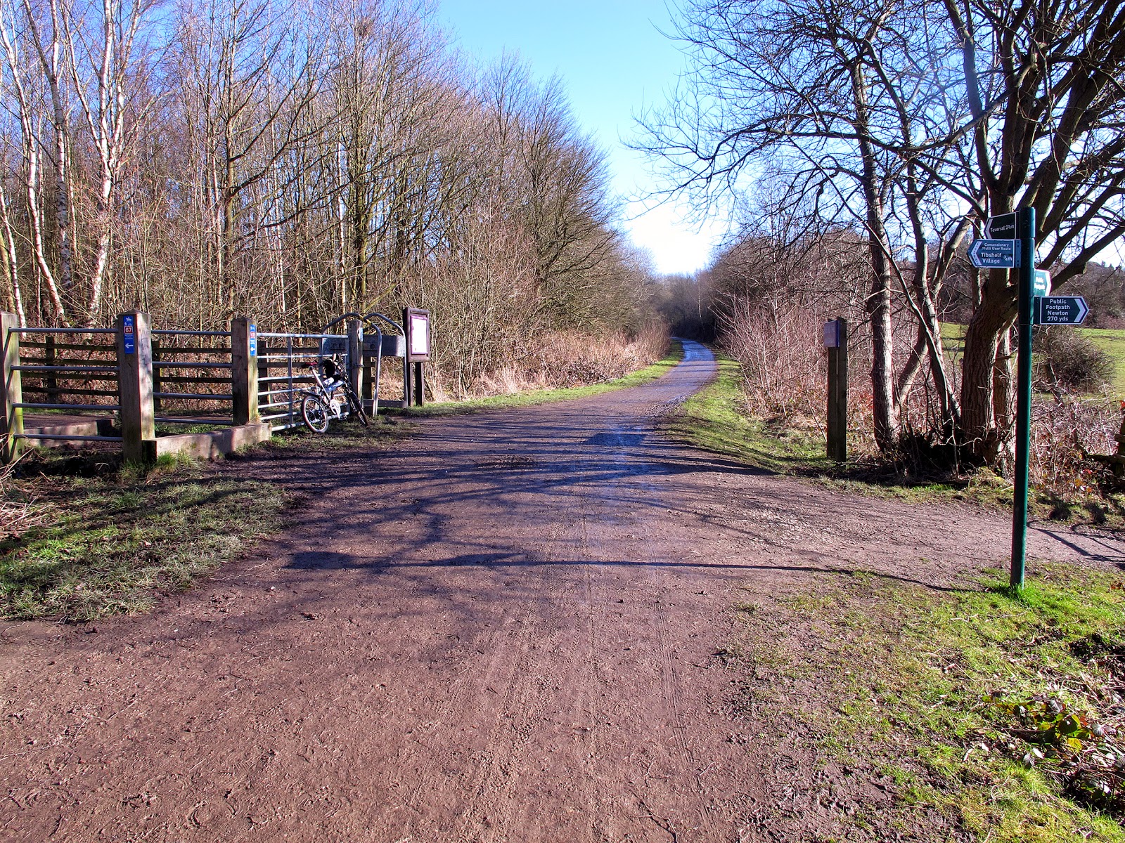
And this is the junction of the Five Pits Trail and the newer Silverhill Trail which is Route 67 of the National Cycle Network.  In this view the Five Pits Trail is on the left.  So turn right at the gate following sign to Alfreton.


The Silverhill Trail has been built to the newer standard of Derbyshire County Council with a good 3 metre wide path.
At the western end of the Silverhill Trail a small bridleway leads onto the road at Westhouses and hence, following signs, to Alfreton, where there are plenty of places for refreshment.
From here to Derby is mostly on road that being the A61 which is not so bad for cycling as it has marked cycle lanes for much of it's length and the nearby A38 trunk road takes most of the motorised traffic.
The relatively short Ripley Greenway and a nice cycle path in Little Eaton bring us back to join NCN Route 54 which, although not one of the better NCN routes, does at least get us across the busy A38. and by way of Haslam's Lane, takes us into Darley Fields and along the Riverside Path into Derby City centre at Exeter Bridge, the meeting point of most of Derby's NCN routes.

Friday, 5 December 2014

Space for Cycling

The disastrous design of the new London Road bridge illustrates how far away we are here in Derby from having a 21st century local cycle network.
There are some excellent cycling facilities in the Riverside Path, the traffic free routes through Mackworth and Mickleover, and the path on Racecourse Park which leads to the Breadsall Greenway. 
Even in the city centre we have a few inspired on road cycle lanes, such as the one on Exeter Bridge, the contraflow lane in the Wardwick, and more recently the well designed cycle lane on Babington Lane.  The new Inner Ring Road has such good cycling features that the Council received an award from Derby Cycling Group.
However, the main reason why we do not see more people on two wheels is that most on-road cycle lanes are intermittent and do not join up, dissuading potential and nervous cyclists from using them..
Take for example the Uttoxeter Road, which runs out to Mickleover. Some short stretches have good cycle lanes but they suddenly end in the middle of nowhere, and cyclists are then exposed to following motor traffic which is often travelling too fast and too closely.
Many more people would cycle if these problems were tackled, but we can see that why they are not when we hear how many of our councillors have signed up for the Space for Cycling campaign.
Only three of the 51 have signed up!
Please ask your councillors to take a look at this video and ask them these questions.
Will you sign up to the campaign?  And if not, why not?

Click HERE for the video.

Tuesday, 2 December 2014

London Road Bridge

A major traffic problem in Derby for the last 18 months has been the replacement of the bridge over the railway on London Road.
During that period, a temporary structure has been in place alongside the construction site and so pedestrians and walking cyclists have been able to use the London Road route between Wilmorton and the City Centre. This has now been removed.
No such luck for motorists however and they have added to the other local road chaos caused by serious road works at the A38/A61 (Little Eaton) and A38/A52 (Markeaton) roundabouts.
So what of the new bridge?
For the increasing numbers of automotive hotheads, a new race track, but for cyclists and pedestrians a very dangerous place to be.  My recommendation is to avoid it if you possibly can.
There are no cycle lanes and the pavements are so narrow (only 1.4m which is 55 inches) that there is hardly room for two pedestrians to pass and as for pushchairs, wheelchairs and mobility scooters very little chance without one of them stepping into the road.
To say that this is a recipe for disaster would be an understatement.
Here some photographs to show the extent of the problem.


This is how much road width is available to cyclists and pedestrians who may step off the pavement.


A lady with two shopping bags takes up most of the pavement width.
 
                                                       As does this pavement cyclist.


                         What happens if this young mother meets a wheelchair or mobility scooter?
                                                             Who will step into the road?

                           Young mother with pushchair at risk from traffic and illegal cyclist.

                                                 Space for cycling?  Hardly.

                                  One of the primary objectives was "To improve Road Safety".

 Broad shouldered workman almost blocks pavement
 
More to come on this subject as it is early days yet, work still in hand on the North side pavement (which is the wider of the two), and traffic levels not having yet built up. Buses are using the bridge, but little sign of 40 ton artics at present.
Also there is a temporary pedestrian crossing close to the Bateman Street junction and this has a calming effect on the vehicular traffic.