Pages

Saturday, 10 October 2015

Foxton Locks

This is a beautiful 14 mile (return) flat and traffic free ride along the towpath of the Grand Union Canal, which wanders between Market Harborough and Foxton Locks in Leicestershire.


We follow the signs for Route 6 of the National Cycle Network which is opposite the railway station in Market Harborough, where there are frequent trains from Derby via Leicester.  Although initially on the same route as the Bramcote Valley Way, following the River Welland, the route to Foxton diverts through Welland Park and a few urban streets before the meandering canal heads Northwards and later Westwards.


The railway station at Market Harborough (right)


Follow Route 6 and not Route 64.


                                                    Rattle along the wooden walkway.

                   NCN 6 runs alongside the River Welland through pedestrianised shopping centres.
The exit from Welland Park.  Turn right here.

Following this sign.


Right at junction.


And left onto Logan Street, going left at the top of the hill to access the canal by way of a narrow alleyway.


On reaching the canal towpath, turn right to Union Basin which is the terminus of the Grand Union Canal in Market Harborough.  We will return to this point after visiting Union Basin and continue along the path i.e. left here towards Foxton.

The approach to Union Basin.

And the basin itself. Waterfront Cafe (right) recommended.

A fine sculpture on the quayside.

We retrace our steps (tyremarks) to the alleyway and continue along the winding towpath towards Foxton some six miles hence. The path surface is hard and stoney all the way.

This way to Foxton.


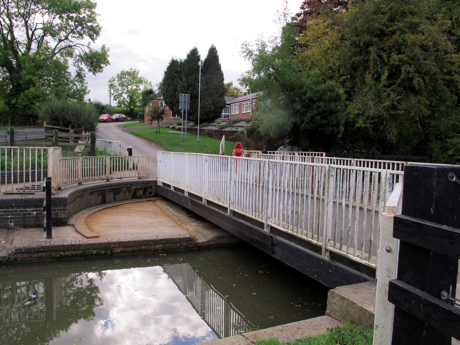
So far we have been on Route 6 of the National Cycle Network, but here at this swing bridge Route 6 leaves the canal and goes up the hill opposite, missing Foxton Locks.

Through the gate and straight along the towpath.........................

.................take us to the locks at Foxton..............................

....................and another manually operated swing bridge.


The flight of 10 locks rises up the hill from here, and X marks the top lock.

The Foxton Locks Inn opposite is one of many places to eat and drink around the basin below the flight of locks.

The view from the top lock is spectacular.

The white cottage was once the home of the lock keeper and is now an excellent cafe.

A good choice of food and drink at reasonable prices.

A statue of Jack Cryer, once lock keeper who lived, with his family, in the cottage


This fine sculpture of a horse stands alongside the canal above the top lock.


Access to the other side of the canal  is across this bridge where you can see the disused link to the remains of the inclined plane. This leg of the canal leads to Birmingham and London.

No boats traverse this link.

 Water lilies and reeds grow where boats no longer go.


The remains of the inclined plane.........

... which once was used instead of the locks to carry boats up and down the hill in steel containers hauled by a steam engine.
From here a view of the top few locks and also the side ponds which hold the water drained from one lock, so that it can be used to fill the next one further down the hill.

A quiet mooring for these boats in the side leg of the canal at the bottom of the inclined plane.


Sunday, 27 September 2015

Brampton Valley Way


This ride is about 18 miles long and runs along the previously disused railway route between Market Harborough and Northampton.  It is fairly straight, there are no hills, and the surrounding countryside is pleasant rather than spectacular.
The salient features are two long, dark and unlit tunnels, (for which you need good lights on your bike), a considerable number of substantial seats, some excellent mosaic displays, and the Lamport and Northampton Heritage Railway, which runs alongside the path towards the Northampton end of the ride.
The path itself has, for the most part, wide grass verges and is tree lined, but the surface is mediocre, and does not lend itself to speedy progress.

We start from the railway station at Market Harborough,
(see right) following the well signed route which shortly passes both Aldi and Waitrose supermarkets, handy for taking on food and drink, as there are no such facilities until you get to Northampton. apart from the buffet at the heritage railway, which is open only on Sundays.


                           You cannot get lost on this ride as the signing is excellent.

                      Rattle along this wooden walkway which is opposite the railway station............


                                          .............  and out into the countryside.


After a few miles we come to the first tunnel which has no lighting and you really need two good lights on your bike.  One pointing directly ahead and one pointing downwards so that you can see the surface of the path beneath your front wheel. The surface is smooth but undulating and there are many muddy puddles.

This is the entrance to the Oxendon Tunnel and you can just see daylight at the far end.  At the mid point there is a vertical shaft which allows a little daylight to enter.  This would, of course, have  allowed smoke from the steam engines to escape when trains ran through here.

View inside tunnel


               And here the entrance to the Kelmarsh Tunnel which at 480m is the longer of the two, Oxendon Tunnel being 418m long.

 The exit from the tunnel brings us back out into the daylight and the rising woodland path.


As we pass beneath a road we find  graffiti, which, though unsightly, is at least helpful.
                                           Several side paths lead to nearby villages.

             And as we cross minor roads there are substantial barriers to prevent motor vehicles straying onto the path.

                           There are several examples of artistic mural panels along the route.

                                                     And lots of very substantial seats.

 The Sustrans milepost indicates that we are now 8 miles from the start at Market Harborough and have a further 10 miles to go.

                                         Nice views across the surrounding countryside.

 At this wooden walkway we arrive at the Northern limit of the Northampton and Lamport Heritage Steam Railway, where it would seem that some restorative work will be necessary before the line can be extended in this direction.

                                                   But at least trains can come this far.

                                  And here are the trains, many in need of some TLC.

                            A couple of shunters, a nice little saddle tank and a diesel shunter.


                                     And lots more rolling stock awaiting re-furbishment.

 Beyond the Pitsford  and Bramcote Station is this fine signal box and in the foreground a very artistic mosaic of it.

             Cross the road and onto this 3 mile tarmac path which leads us into Northampton.
 Coming towards Northampton. Not particularly scenic, and note that it is not possible to return directly to Market Harborough by train since the two towns are not on the same line. We have, of course just ridden over the original, and most direct route. There are buses, not much use unless you have a folding bike, or you can take a train via Rugby (!) which takes a couple of hours. So best to cycle back the way we came.

Sunday, 20 September 2015

Keswick Railway Path

The Keswick Railway Path is a short but spectacular section of the C2C (Coast to Coast) Route, being Route 71 of the National Cycle Network. It follows the rocky gorge which contains the River Greta, crossing it no less than 8 times in the four miles of the path.


The lakeland town of Keswick makes an ideal overnight stop for cyclists tackling the entire length of the C2C route, and this section starts at the local leisure pool at the bottom of Station Street.


 We turn right at the entrance to the pool

 ...................... and find the path at the rear of the building


 ........and the old station buildings a short distance away.  Opposite is a handy car park.


 Soon we make our first crossing of the River Greta on this wooden structure which is supported by the steel girders of the original railway bridge.

                                           There are several road bridges crossing the path,


                                              And the inevitable Sustrans milepost


 Here we go onto the wooden walkway which clings precariously to the rocky face of the gorge.


                     The River Greta tumbles over the rocky bed.


                                            Tunnel and bridge in close proximity.

                                                            At last- the final bridge.

            A steep ramp up to the A66 trunk road which has a cycle path to the left...................

                 ..........leading to the village of Threlkeld .....
                                      ...............which is overshadowed by the mass of Blencathra

The village has two pubs and a coffee shop.  Cyclists here heading for the Horse and Farrier Inn.


    And this is the Threlkeld Coffee Shop adjacent to the Village Hall.

The catastrophic flooding caused by storm Desmond in December 2015 did terrible damage to this section of the Coast to Coast Route, washing away many of the bridges and the route has since been completely changed.