Pages

Sunday, 19 July 2015

The Water Rail Way (Part 2)

Woodhall Spa to Lincoln

The Water Rail


The Water Rail Way runs alongside the River Witham between Lincoln and Boston, forming part of  National Cycle Network Route 1, and Woodhall Spa stands at the halfway mark, so it is a good place from which to ride in either direction.  In May 2015 we looked at the ride to Boston and here we look at the ride to Lincoln.
The 17 mile route is, apart from the climb up to the Cathedral, flat and almost entirely traffic free.with an impressive collection of sculptures and lots of information boards giving details of the history of the area.
Lincoln has a railway station but Woodhall Spa does not, so if travelling by rail, best to start the ride at Lincoln. No car parking problems in Woodhall Spa and it has good camping facilities, so the best start point if you are not travelling by train.

                              This is the beautiful city of Lincoln, our destination on this ride.

 And here is Woodhall Spa. To access the riverside path we follow the main street heading SW out of town towards the Kirkstead Bridge.

The road goes over the bridge, but the path to Lincoln goes beneath it, so bear left after this filling station.


Off we go then.  Note that the surface is good tarmac and this goes for most of the route.

                                                       A mileage check here.


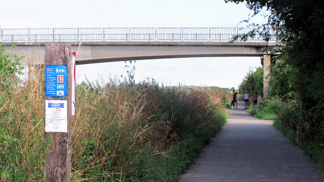
The river meanders through the flat landscape and the path follows it for most of the way, but the floodbanks obscure views in places.

Lots of recreational boating to be seen as there are plenty of mooring berths at Lincoln and Boston, besides many between.

From a distance you might think that these sheep were real, but they are in fact made of scrap metal.


As a closer look will verify.
This is the first of many items of sculpture, some in metal and some are wood carvings, that you will find along side the path.


This wood carving is of a daisy, and was presumable carved on site with a chain saw.  Amazing!


There are several old railway buildings and stations along this route which have been converted into very desirable domestic properties.  This one, at Stixwold, has a most appropriate extension in the style of the old signal box.

Another sculpture here and this one makes you think.
What is it?  What is it made of?  How was it made?
I think that it represents the human form and it is certainly made of wood, in fact two pieces of wood,as there is a vertical joint right down the middle so that the holes are actually cut as depressions in the sides of each half  before they were joined together.
Southrey Station, bearing a striking resemblance to Stixwold Station.

The Water Rail Way is most unusual as it has both a Summer Route and a Winter Route, which diverge from here. The reason for this will become apparent when we go off-road on the way to Bardney, which is three miles hence.

 We leave the riverside going onto the Summer Route which crosses these arable fields and could prove difficult in adverse weather conditions. The Winter Route goes on road.

                                                             Mileage check on the field path.

Another reason for this route is the presence of this sugar factory which stands beside the river.

           The field path leads to the highway which passes through Bardney village. Turn left here.

 In Bardney there is this Railway Heritage Centre which is well worth a visit. Apart from lots of railway and military memorabilia  there is also a cafe.

 And you can even obtain overnight accommodation in these fitted out ex railway vans.

 From the Heritage Centre we go back onto the riverside path through this entrance. The road goes over the river and the entrance to the sugar factory is just out of shot to the left.

                             The path is tarmac now all the way to Lincoln.

 And soon we arrive at Bardney Bridge, the refurbishment of which was pivotal in the opening of the Water Rail Way a few years ago. The opening ceremony was a day to remember with a party on the bridge.  There was a hog roast, a jazz band and people came from all the surrounding villages to join in the fun.

          Close by the bridge sits another sculpture, but this basking shark (?) seems to have lost part of it's lower jaw.

 On the other side of the bridge is this lock which controls the waters of the rather complicated river/canal system.

       And yet another wood carving with the young lady holding my bike for the photograph.


This is Five Mile Bridge, which, would you believe, is five miles from Lincoln. We do not cross it, but keep to the left bank of the river.


More artwork across the path, and below
two cows made from re-cycled scrap metal.


                       Washingborough station is being re-furbished to make a very desirable house.

       As we approach Lincoln we see the Cathedral standing proudly on the ridge above the city.
On into Lincoln now and the rest of the route is not so good, passing though a car park and subject (in July 2015) to diversions due to construction work.

But find your way through the pedestrianized shopping areas and brace yourself for the climb ( ie walk) up this steep hill which is called, (guess what), Steep Hill.

             The reward for your effort is views of the magnificent Cathedral and it's surroundings.


Sunday, 12 July 2015

Rugeley to Fradley (Canal Ride)

Here we are again on the Trent and Mersey Canal, this time riding a short stretch from Rugeley in Staffordshire to Fradley Junction where the T & M Canal meets the Coventry Canal.

                                                    We start at Rugeley Market Place.

The Trent and Mersey canal runs below this bridge, which is numbered Bridge 66.
It is easy to find as it is midway between the two supermarkets, Morrisons and Tesco.

From the bridge this is the view looking upstream, that is towards Stafford.
You can't live much closer to the canal than this.

But this is the way that we are going, that is towards Alrewas via Fradley junction.


The Crown Inn at Handsacre with a balcony overlooking the canal. What better than sitting there on a sunny afternoon with a pint in hand idly watching the boats pass by.

This is the Armitage Shanks factory which looks much bigger on the canal side than it does from the road side. Chances are that some, or all, of your bathroom fittings came from this factory.

                             Another ex lock keeper's cottage and this one happens to be for sale.


                              The approach to Fradley Junction with the Swan Inn ahead.

The Swan Inn at Fradley Junction, where the Coventry canal is on the left of this shot and we are looking back towards Rugeley. As you would expect, food and drink are available at the Swan, but there are two other good cafes here, one behind the Swan and one on the opposite side of the canal.

                    Dining al fresco at the cafe on the right (East) side of the T &M Canal at Fradley.

Wednesday, 8 July 2015

Scarborough to Whitby (The Cinder Track)


Thanks to Dr. Beeching, who closed the original railway line, and to John Grimshaw of Sustrans who re-opened the 22 mile stretch as National Cycle Network Route 1, we can now enjoy it on two wheels.
Although the path starts and finishes at sea level, it is not flat by any means since the first half climbs steadily from Scarborough to the half way mark at Ravenscar, with a commensurate fall back to sea level at Robin Hood's Bay.
So not an easy ride by any means, especially in view of the surface, which gives rise to the name "The Cinder Track". Cinder is not the best top surface for cycle paths as it suffers from erosion, exposing the substrate below which makes for a bumpy ride.  So not a route for flimsy tyres, and mountain bikes/hybrids are recommended.
In spite of these, not insurmountable problems, it is an exhilarating ride with some great features and spectacular views. If you like great lungs-full of fresh air, this could be the ride for you.


Until we clear the suburbs of Scarborough, the ride is unremarkable, and we lose the sea views, passing through a pleasant pastoral landscape with trees alongside the path sheltering us from the wind.

More gravel than cinders as the path passes between meadowland a few miles inland from the sea.


And emerges here at the village of Burniston and continues on the opposite side. Keep on the pavement and cross at the Toucan Crossing ahead.


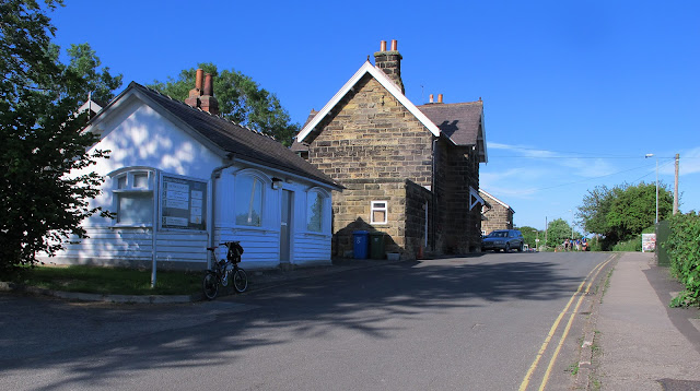
As on so many of the National Cycle Network routes there are are several old stations which have been converted into very desirable houses. This one, at Station Lane, Cloughton, has become a tea room, and also offers self catering accommodation.
There is plenty of car parking space in the old Goods Yard


Directly opposite, the path continues through this gate.  Note yet another Sustrans milepost on the right.


                                The path really looks like a railway route on these two shots.

But the long drag uphill must have made the old steam engines puff somewhat. Just like humans on bikes!

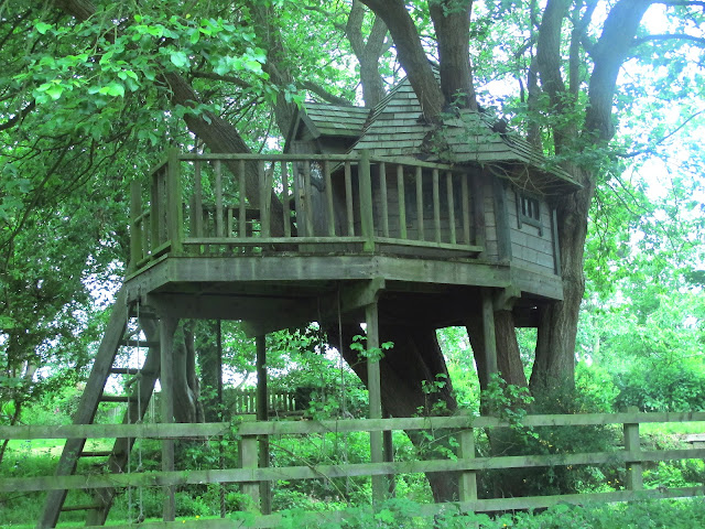
As station conversions go this one must be one of the best, and with a garden to die for....

                                      ................ including this superb tree house.


Summer wild flowers alongside the path as we go towards the half way mark.

This is Ravenscar where the path goes along what was once the station platform.

And here the Ravenscar Tearooms.

After a short stretch of road we reach the halfway point going straight on here.

Passing this sign which gives all the mileages.
11 miles from Scarborough and 11 miles to Whitby.

A steep downhill run onto a really bad surface which fortunately has a narrow peice of better tarmac alongside.

                  And a distant view across the water towards. Robin Hood's Bay (marked X).  
                                              The Cleveland Way meets our path here.


                                                            Looking back up the hill.


                                  This is the site of a WW2 radar station.

                                                           With nicer views of the sea.
                                                     But on with the ride now heading for Whitby.

             With reminders that this was once a railway running from Scarborough to Whitby.


                                       We keep left of this unusual church tower

Going straight on here.

Passing this redundant station (Fylingthorpe) and the adjacent car park where there are toilets.

To the higher part of Robin Hoods Bay which is (appropriately) called Upper Bay, and turning right to go down to the sea (Lower Bay).
On our return we come back to this point and go to the left.

The road downhill is precipitous, so walk down if you are at all nervous or have poor brakes.
                                                       You'll be walking back up anyway.

Some amazing houses clinging to the steep sides of the valley here in Robin Hood's Bay, once the haunt of smugglers who could outwit the Excise Men  in tunnels which run beneath and between some of the cottages.

                     The Bay Inn stands alongside the beach and is the finishing point for the Coast to Coast                                               Walk which Alfred Wainwright made famous.

The beach below the Bay Inn.

                     National Trust land between the path and the sea here on our right.

And yet another reclaimed railway station as we near to Whitby, now only 2 miles away.
This is Hawsker Station, where you can not only hire a bike, but buy a new one, get drinks and refreshments, and even take accommodation in one of the beautifully re-fitted railway carriages.
Not only that but the guy who runs this outfit used to live in Littleover and worked for Derbyshire County Council. Just ask for Keith.


You might think that this is just a road with walls on either side, but look over the parapet to see the River Usk 120 feet below. This is Larpool Viaduct, a spectacular brick structure which once carried the railway across the river.  It is a grade 2 listed structure and is reputed to consist of 5 million bricks.


There are two fascinating videos, on YouTube, one with photographs of the construction of the viaduct, Click HERE to view one and HERE2 for the second which has spectacular drone shots of the structure as  it is today.
View of the River Usk looking towards Whitby which lies behind the trees on the left. Whitby Abbey top left marked X.


As we drop down towards river level there is a better view of the Abbey and the (mostly) pleasure
craft alongside the river

                                       Saint Mary's Church stands high on the hill above the town


                                                   And here we are at the beach.


No visit to Whitby is complete without sampling the local fish and chips and the best places to get them is the one with the longest queue outside.  Usually that is the Magpie Cafe beside the harbour.  'Nuff said!