Thanks to Dr. Beeching, who closed the original railway line, and to John Grimshaw of Sustrans who re-opened the 22 mile stretch as National Cycle Network Route 1, we can now enjoy it on two wheels.
Although the path starts and finishes at sea level, it is not flat by any means since the first half climbs steadily from Scarborough to the half way mark at Ravenscar, with a commensurate fall back to sea level at Robin Hood's Bay.
So not an easy ride by any means, especially in view of the surface, which gives rise to the name "The Cinder Track". Cinder is not the best top surface for cycle paths as it suffers from erosion, exposing the substrate below which makes for a bumpy ride. So not a route for flimsy tyres, and mountain bikes/hybrids are recommended.
In spite of these, not insurmountable problems, it is an exhilarating ride with some great features and spectacular views. If you like great lungs-full of fresh air, this could be the ride for you.
Until we clear the suburbs of Scarborough, the ride is unremarkable, and we lose the sea views, passing through a pleasant pastoral landscape with trees alongside the path sheltering us from the wind.
More gravel than cinders as the path passes between meadowland a few miles inland from the sea.
And emerges here at the village of Burniston and continues on the opposite side. Keep on the pavement and cross at the Toucan Crossing ahead.
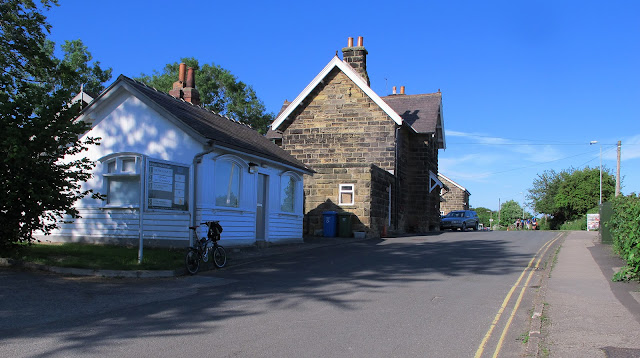
As on so many of the National Cycle Network routes there are are several old stations which have been converted into very desirable houses. This one, at Station Lane, Cloughton, has become a tea room, and also offers self catering accommodation.
There is plenty of car parking space in the old Goods Yard
Directly opposite, the path continues through this gate. Note yet another Sustrans milepost on the right.
The path really looks like a railway route on these two shots.
But the long drag uphill must have made the old steam engines puff somewhat. Just like humans on bikes!
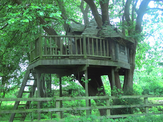
As station conversions go this one must be one of the best, and with a garden to die for....
................ including this superb tree house.
Summer wild flowers alongside the path as we go towards the half way mark.
This is Ravenscar where the path goes along what was once the station platform.
And here the Ravenscar Tearooms.
After a short stretch of road we reach the halfway point going straight on here.
Passing this sign which gives all the mileages.
11 miles from Scarborough and 11 miles to Whitby.
 A steep downhill run onto a really bad surface which fortunately has a narrow peice of better tarmac alongside.
And a distant view across the water towards. Robin Hood's Bay (marked X).
The Cleveland Way meets our path here.
This is the site of a WW2 radar station.
With nicer views of the sea.
But on with the ride now heading for Whitby.
With reminders that this was once a railway running from Scarborough to Whitby.

We keep left of this unusual church tower
Going straight on here.
Passing this redundant station (Fylingthorpe) and the adjacent car park where there are toilets.
To the higher part of Robin Hoods Bay which is (appropriately) called Upper Bay, and turning right to go down to the sea (Lower Bay).
On our return we come back to this point and go to the left.
You'll be walking back up anyway.
The Bay Inn stands alongside the beach and is the finishing point for the Coast to Coast Walk which Alfred Wainwright made famous.
The beach below the Bay Inn.
And yet another reclaimed railway station as we near to Whitby, now only 2 miles away.
This is Hawsker Station, where you can not only hire a bike, but buy a new one, get drinks and refreshments, and even take accommodation in one of the beautifully re-fitted railway carriages.
Not only that but the guy who runs this outfit used to live in Littleover and worked for Derbyshire County Council. Just ask for Keith.
You might think that this is just a road with walls on either side, but look over the parapet to see the River Usk 120 feet below. This is Larpool Viaduct, a spectacular brick structure which once carried the railway across the river. It is a grade 2 listed structure and is reputed to consist of 5 million bricks.
There are two fascinating videos, on YouTube, one with photographs of the construction of the viaduct, Click HERE to view one and HERE2 for the second which has spectacular drone shots of the structure as it is today.
View of the River Usk looking towards Whitby which lies behind the trees on the left. Whitby Abbey top left marked X.
As we drop down towards river level there is a better view of the Abbey and the (mostly) pleasure
craft alongside the river
Saint Mary's Church stands high on the hill above the town
And here we are at the beach.
No visit to Whitby is complete without sampling the local fish and chips and the best places to get them is the one with the longest queue outside. Usually that is the Magpie Cafe beside the harbour. 'Nuff said!


I like your writing style and appreciate your efforts. houses for sale in scarborough
ReplyDelete