Pages

Thursday, 8 June 2017

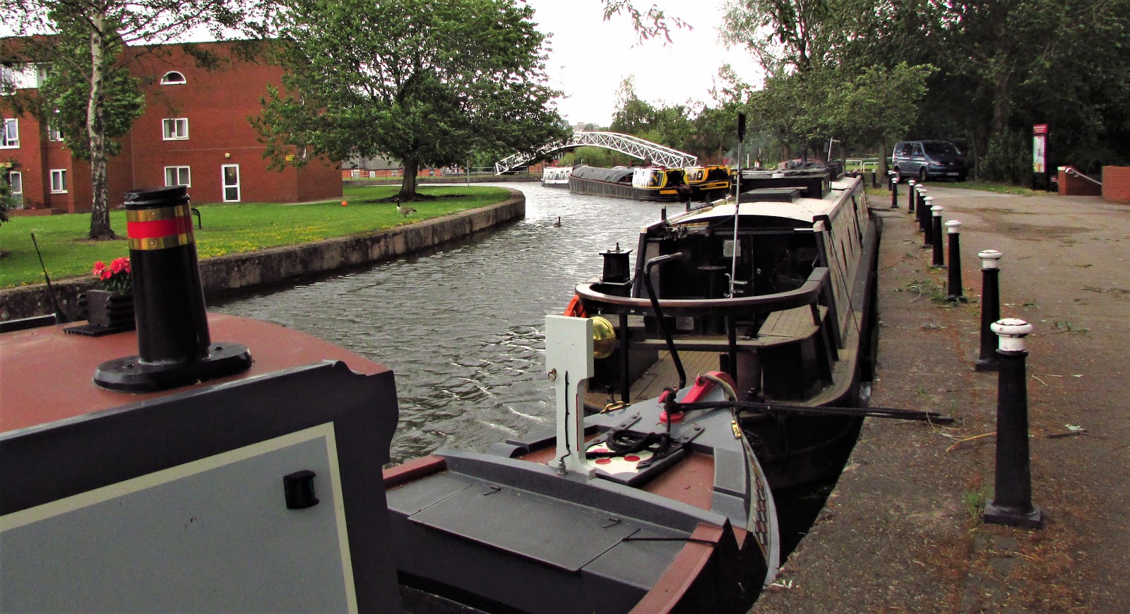
Stoke-on-Trent to Leek (Canal Ride)

This spectacular ride of about 15 miles each way takes us from the Potteries to the Staffordshire Moorlands by way of the Caldon Canal which is an offshoot of the Trent and Mersey Canal.
The Caldon Canal is close by Stoke railway station and there is a good rail service from Derby, costing around £8 for a return ticket if you have a Railcard.

An unremarkable start below the busy streets of Stoke.

In fact pretty grim looking concrete locks further desecrated by mindless graffiti, but stick with it - it gets better as we go on.

Improving .............................

....... but we're a long way from Derbyshire.

Lots of industrial buildings alongside the canal to remind us of busier times.

The tall locks remind us that we are heading to a higher landscape.
 In fact the canal rises by 150 feet by the time we get to Leek.


 We are following Route 550 of the National Cycle Network.


Etruria where there is an industrial museum alongside the canal.

Yet more locks!

And more industrial buildings.

Note that the path has an excellent surface and this continues for most of the way.

Passing Hanley Park. There are public toilets here, but not of a high standard. (Pretty grim in fact).

And bottle kilns, a reminder of the area's industrial heritage.

Now this is more like.

Nice gardens at these houses.


Approaching the flight of locks at Stockton Brook.

Unusual sculpture alongside the locks.


Above this lock we cross on the road bridge to the left side of the canal.

Into open country ............................

Canada geese with lots of goslings.


Here the canal divides, with the left branch going on towards Uttoxeter and the right branch going to Leek by way of an aquaduct.

The Uttoxeter branch drops down at these locks to pass beneath the Leek branch.

Only a grass towpath here for a short distance.

A sharp left turn here as we cross this bridge to access the aquaduct.

This is the aquaduct............

.........with the Uttoxeter branch below.

Back to the right bank again.

Some lovely places to live out here.


Here the entrance to the Leek tunnel, less than 400 yards long but no towpath, and whilst boats get through in only 3 minutes, land transport has to go over the hill.


...by way of these steps, which fortunately have a bike wheeling ramp alongside.
In the days of horse drawn barges the animals would have been led over the hill on a bridleway path, which still exists.

Looking back down the steps we see the large lagoon where boats wait their turn to pass through the tunnel.
No steps on the other side, instead a very steep path down to water level. We are now almost in Leek and no doubt ready for refreshment.
Two recommendations -
Morrison's supermarket, just through the industrial estate.
And Wetherspoons which is the Green Dragon in St.Edward Street.


And a video of the first part of the cycle ride from Leek to the Tunnel

And a video of the locks at Stockton Brook

Tuesday, 6 June 2017

Willington to Stenson (Canal Ride).

This short route along the towpath of the Trent and Mersey Canal has all the ingredients of the ideal bike ride. It has no traffic and no hills, lots of wildlife, boats and waterside views.  There is even a pub and a marina at each end!  The South Derbyshire villages of Stenson and Willington are very different however. Apart from the lock keeper's cottage, now an excellent cafe, the marina and the nearby Bubble Inn, Stenson has little else.
Willington however, is much larger, having everything that a village might need.  There are three excellent pubs, a supermarket, and even a railway station. Nearby Mercia Marina, on the Northern outskirts of the village, was until recently a small trout fishery near to the Trent and Mersey Canal.  It has been transformed into one of the largest and most modern marinas in the country with cafes, shops, holiday chalets and moorings for over 600 boats.
Willington is close, but not too close, to the junction of the A50 and A38 trunk roads, so access is good from all directions. The five cooling towers of the de-commissioned coal fired power station serve as markers for the village and can be seen from a great distance over the flat lands of the Trent Valley, as the river flows from Burton-on-Trent to Nottingham.


We start here from Mercia Marina. The steel structure in the background is an extension of the shopping  complex.
Looking Eastwards the five cooling towers of the redundant coal fired power station. The water is the link from the marina to the canal, this running beneath the Findern to Willington road.


Access to the towpath is from the canal road bridge. On the right is the garden of the Dragon PH to which we will return on completion of the ride.


                  Off we go then, heading for Stenson Lock.


                   The towpath is fairly basic but well worn by walkers.

             
Water irises along side the bank.


The village of Findern is midway along the route but we see little of it, and another pub, once the Greyhound, later the Canal Turn and now reinvented as Nadee Indian Restaurant and Bar. Access via the road bridge.


                          Looking back from beneath the bridge.


Arrival at Stenson Lock. Plenty of boats here, due to the marina, cafe and pub. 


This is the old lock keepers cottage now an excellent cafe, open until 5pm everyday throughout the Summer, and serving basic food at reasonable prices.
Highly recommended.


With covered dining overlooking the lock.


Standing back from the canal is the Bubble Inn. Good food and drink here.
The "Bubble" is the overflow water drain which takes excess water which originates from the River Trent, and bypasses the lock.

A boat traversing the lock, which has a height of 12 feet. The top gates weigh 950Kg each and the lower gates, subject to much higher water pressure weigh 2920Kg each.


                                                   The road bridge

                       View looking downstream from the road bridge.


Suggested return route back to Willington following the outward route and stopping at the Dragon for liquid refreshment.


A very popular pub, the Dragon is always busy and this is midweek.
The enormous lawn is actually artificial grass. No weeds, no mowing, just Hoovering.

Cheers!

Click HERE for video of the return journey on YouTube.

Sunday, 9 April 2017

Breadsall Greenway - the Early Days

On a cold but sunny day in January 2006, a group of Sustrans Rangers were exploring possible new off road cycle routes and rode off to look at the disused railway at Breadsall. We had been told by Sustrans that it would never be an official cycle route as "it goes nowhere".
Derbyshire County Council had better ideas and two years later were hard at work converting the hilly and muddy path into a hard surfaced multi purpose route.  It was not an easy task as the derelict railway was not flat due to unstable ground and the removal of some bridges when the rail closed in the 1960s, another victim of  Dr. Beeching.

Prior to that, the Great Northern Railway crossed the then town of Derby from North East to South West with Friargate Station the focal point in the centre. A large brick viaduct crossed the valley about where the Meteor Centre stands today and the railway crossed City Road at Chester Green and the River Derwent on Handisides Bridge which is now a pedestrian/cycle route.


Breadsall had a fine station together with a signal box, a lamp shed and a level crossing. The Station Master, Mr. Joseph Taylor, his family and the Station Cat, Timmy, lived in a house adjacent to the station.

The train above was about to pass beneath the A608 road seen here after the line was closed.
Subsequent road widening meant that the bridge was part demolished and the cycle path had to go over the remains with access on the steep bank seen on the right here.

                                     Lots of trees were felled to achieve this.


All that remains of the station platforms today


The trackbed was not bad in some places ............................

                                          ...but much worse in others.


New fencing was erected along the new path. This piledriving machine is so powerful that the posts are square ended and not pointed as you might expect.

The path originally ended at the junction with the A608 road but in 2013, Derbyshire County Council completed Phase 2 of the project taking the path  another 2km in the direction of Ilkeston, it's ultimate destination.
Note that the route was originally designated as Route 66 of the National Cycle Network, but was renamed Route 672 to avoid confusion with the Regional Route 66 which encircles the City of Derby.

Elsewhere  on this blog, you will find  a post with photographs of the Phase 2 path.
Click HERE for that.


Sunday, 2 April 2017

Boston Lincolnshire

The flat lands of The Fens around Boston are good for cycling as there are very few hills of any consequence and there are lots of interesting features to be seen. National Cycle Route 1 brings the Water Rail Way into the town from Lincoln via Woodhall Spa alongside the River Witham.
See previous posts here on the Water Rail Way, dated May and July 2015.


St. Botolph's Church, better known as Boston Stump, stands high above the town and is visible from many miles around.  Here it is seen from the large Market Place.

                                                 It stands very close to the River Witham.

                                        Magnificent stone work at close quarters.

The town has not been spoiled by modern developments and many lovely old buildings survive.....


.................................................including some narrow cobbled streets.

                                     The river is tidal downstream of the Town Bridge.


Here  is the harbour, home of the fishing fleet which gathers shellfish from the shallow waters of The Wash.


The Fens abound in artificial waterways used primarily to drain the fertile land, but also used in past times as major transport routes, and more recently for recreational boating.


An unusual road sign alongside the water.


Alongside the West Fen Drain stands the Maud Foster Windmill, an imposing structure still in working order and open to visitors on Fridays and weekends. It is one of the tallest working windmills in the country and unusual in having five sails.
The B1183 runs alongside in the direction of Horncastle.


The country lanes around Boston are ideal for cycling this circular route taking us around the North west side of the town to join the Water Rail Way at Anton's Gowt . This is actually the name of the nearby village and the word "gowt" means a drain. Presumably it belonged to Anton.

The locks here join one of the large drains to the River Witham and would no doubt have been used to control the relative water levels especially at times of flooding rather than, as on most canals, to enable the passage of boats.
This viewing tower was erected as a feature on the Water Rail Way...................

................... giving better views of the surroundings ...........................


...............although Boston Stump is visible from far away.