
This is my favourite route; not the shortest by any means, but it avoids most of the road traffic and minimises the inevitable hill climbing. Quite scenic in parts too; at least compared to the other routes.
The overall distance is 4.92 miles, a mile or so longer..
So take seat, we have 64 slides to look at.
Enjoy the ride.
 |
| We start in the Market Place with the Council House and Exeter Bridge ahead. |
 |
| There is a well designed and safe dedicated cycle lane on the river bridge. |
 |
| Turn first left after the bridge into Stuart Street. |
 |
| Keep the NatWest building on your right. |
 |
| And turn left onto the path at the light blue sign which points to the Cathedral, Riverside Path, and the Silk Mill. |
 |
| The path leads to the riverbank and the pedestrian/cycle swing bridge.. |
 |
| From the bridge there is a good view of the 14th Century Cathedral, which has nesting peregrine falcons on the tower in the springtime. The tower is 212ft high. |
 |
| And there is a view of the Silk Mill, now an Industrial Museum. |
 |
| Alongside the Cathedral is a statue of Bonnie Prince Charlie who, in 1745 marched his troops all the way from Scotland with the intention of taking over the English crown in London, but decided after coming this far, that it wasn't such a good idea after all, and so they all marched back again, subsequently being defeated at the Battle of Culloden, near to Inverness.. |
 |
| Our route squeezes between the river and the Silk Mill |
 |
| To pass beneath St. Mary's Bridge, where the country's first public street lighting was installed. People came from miles around to marvel at the flickering gas lamps. |
 |
| The Riverside Path has a good tarmac surface and is a popular route for both cyclists and pedestrians. Here it is Route 54 of the National Cycle Network, going as far as Little Eaton. |
 |
| Further on we pass beneath Handyside's Bridge which was built to carry the Great Northern Railway across the River Derwent. A minor railway ran under this arch to a siding. |
 |
| Immediately after the bridge we turn left on a rising path before the Rowing Club building ahead.. |

Following this sign, which like others locally, encourages cyclists by quoting distances in minutes rather than miles.
A shrewd psychological ploy as it doesn't seem so far then to the faint-hearted..
 |
| Up this path to turn right ........................... |

.......at the path junction following this sign to the right.
We are heading towards Mackworth and will pass Britannia Mill.
 |
| To our left is the deck of Handyside's Bridge, now an excellent river crossing for pedestrians and cyclists. When trains ran across here there was a pedestrian route on the outside of the bowstring girders. |
 |
| Onto North Parade here where once the road was on a bridge over the railway. |

Right next into North Street which then crosses Arthur Street.
 |
| Here. |
 |
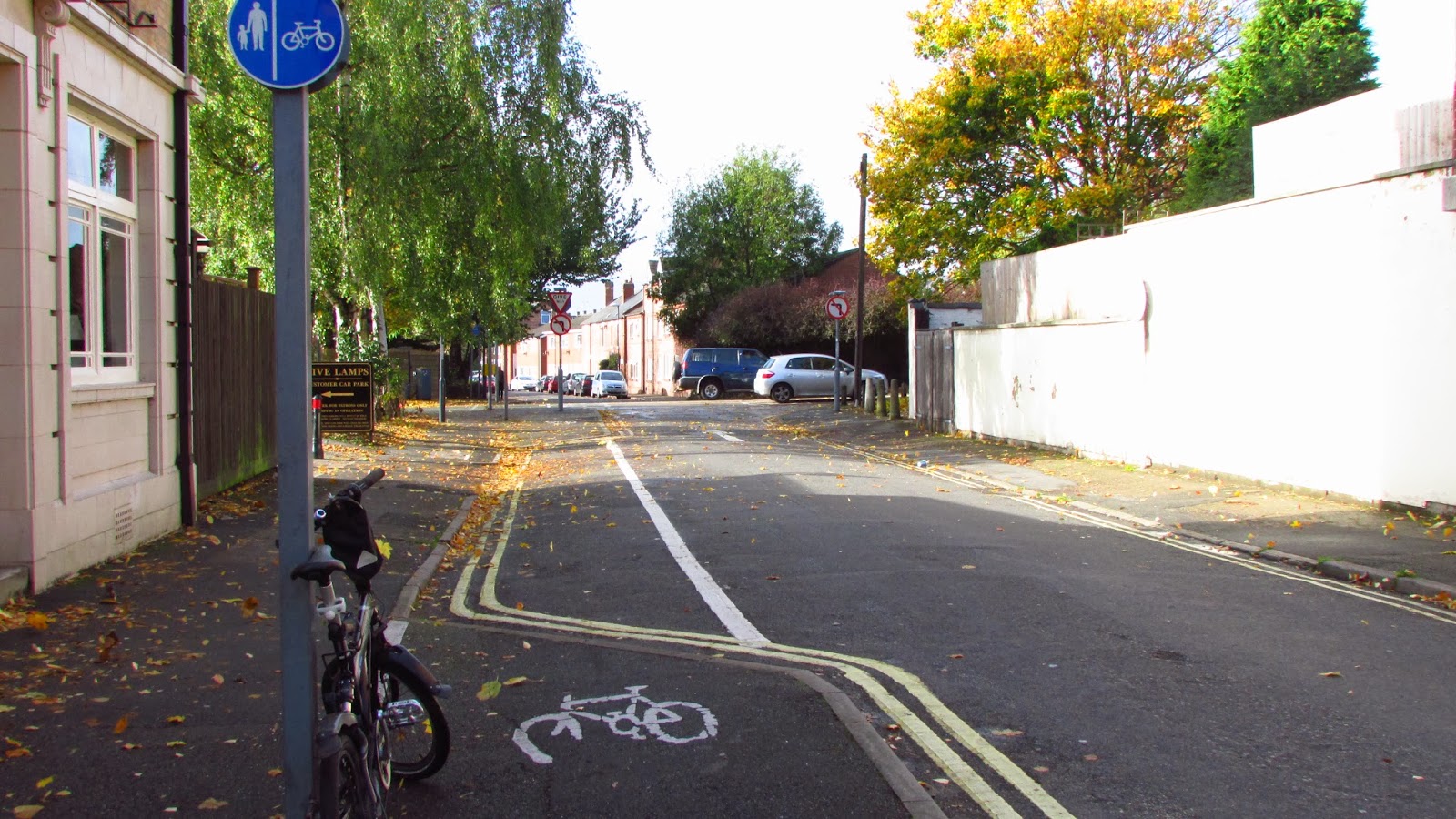
| Keep right on the cycle path to cross Duffield Road at the award winning Five Lamps pub. |
Following this sign
 |
| And straight on to the junction with Garden Street. |
 |
| Yet another Toucan crossing |
 |
| Straight on here. |
 |
| Through the posts. |
 |
| To the junction with Nuns Street. |
 |
| And turn right through the posts here onto the pedestrian and cycle path............................ |
 |
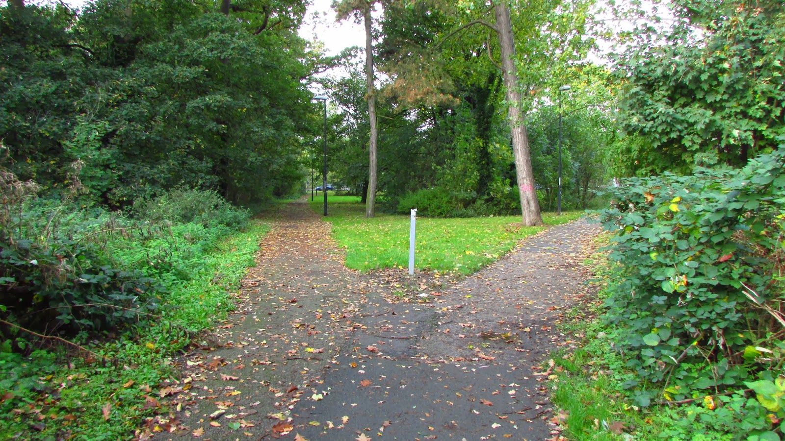
| ,,,,,,,,,,,,,,,,,,which runs through to Mackworth Recreation Ground. |
 |
| Here. |

Through the trees to cross the park..
 |
| And turning left here. |
 |
| Up to the road, which is Mackworth Road. |
.

Ahead is Britannia Mill, now the Arts Department of the University. The 18th century mill much improved in recent years
 |
| At the crossroads, turn right into Markeaton Street which runs alongside Markeaton Brook. |
 |
| This is the mill pond, a reserve of water for the water wheel at the mill. |
 |
| And on the left more University buildings. |

 |
| A nice path runs on towards the Derby Ring Road ahead. |
 |
Keep on the left path here, beside the Curly Bridge, which is not visible due to leaves on the trees.
 |
| Oh! Here it is, crossing the busy A38 trunk road. The bridge takes pedestrians painlessly into Markeaton Park. It has helical access ramps, hence Curly Bridge. |
 |
Left here on the path and service road to reach Markeaton Roundabout, well known planning disaster and traffic bottleneck.
Not to worry, we can get past it safely on a bike.........................................
|
 |
| .....................................as there is a pedestrian crossing over Asbourne Road. |


 |
| Invaluable for cyclists. Our local Pedal Pals are out on their Sunday morning ride |
 |
| Unfortunately, if you are going to Mickleover then you have to climb somewhere, and this is it. |
 |
| To the summit at Windmill Hill Lane. Straight on here. |

Only 9 minutes to Mickleover now!

Straight on again here on Thurcroft Close through the posts to cross Raleigh Street.
 |
| Look right then look left here. |
 |
| Turn right at Brackensdale Avenue to pass under the twin bridges of the A38. This looks like an accident waiting to happen, but the car didn't hit the cyclist. I had my camera at the ready though, just in case. |
 |
| First left onto Greenwich Drive South. |
 |
| Off road now at the Sustrans mile post onto the tarmac path which takes us through the verdant grasslands of Mickmack Park, a green wedge between Mackworth and Mickleover. |
 |
| This is a section of the National Cycle Network, being coincidentally both Route 54 and Route 68. They diverge at Etwall, one leg (Route 54) going on to Burton-upon-Trent and the other a further 350 miles Northwards to Berwick-upon-Tweed, just South of the Scottish border. |
 |
| A pleasant ride but inevitably uphill. |
 |
| Left at the signpost. |
 |
| Follow this guy, sensibly attired in high visibility clothing |
 |
| But watch out for loose dogs. They have no road sense at all, but usually manage to get out of the way at the last moment. |
 |
| Turn right here .................. |

.....................following this sign.
Mickleover only two minutes away now!
 |
| We are now in Mickleover at last. The big gate is locked and the small gate not designed for tandems, trailers, kid's buggies or obese people. |
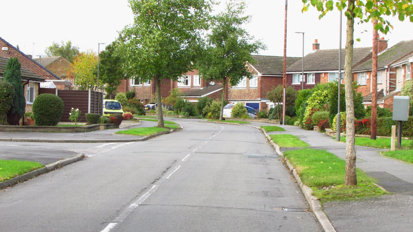 |
| On reaching Onslow Road turn right and follow it through to the junction with Station Road |
 |
| Station Road ahead. Turn right here, but look out for high speed traffic (i.e. 30mph+) |
 |
| On then for 200m where, on the left, is the entrance to the Mickleover Greenway running five miles off-road. |
 |
| This is start of the Greenway, with the old Mickleover Station ahead. It is now a private house. A future slideshow will take you from here to Etwall. |
I know the route well, but a short while ago I had the pleasure of following the great Peter Ford along the same route, to my amazement he turned right at picture 25? where you say ‘straight on’. A quick left then right and we came out just beyond the picture ‘here’.
ReplyDeleteWho says you cannot teach old dogs new tricks…I now prefer his route as the parked cars beyond the bollards are a constant hazard. You show the route on a quiet Sunday, a weekday would have made a difference.
Well done for finding a sunny day!
Sounds a good idea. Will check it out . .....when we get another sunny day!
ReplyDelete